MONITORING & MANAGEMENT
European Frog-bit Monitoring
Detecting an invasive species early provides the most realistic chance for management activities to successfully eradicate the population. However, aquatic invasive plants are often cryptic and difficult to locate before widespread population growth. Detecting a species requires thorough surveillance of all preferred habitat for a given species. Documentation of surveillance efforts provides critical information on where the target species is found and where it is not.
The European Frog-bit Collaborative is developing a series of ArcGIS tools to assist managers in the Great Lakes region with monitoring and delimiting European frog-bit.
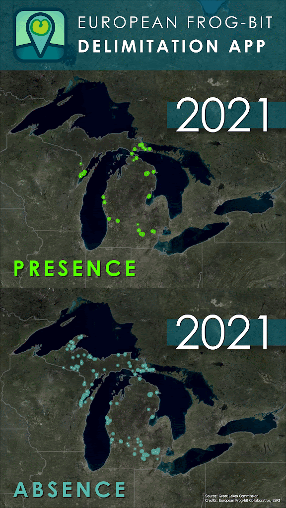
Delimiting European frog-bit in the Great Lakes region
The delimitation app is designed to collect European frog-bit (EFB) surveillance data across a broad range of environments including large waterbodies such as coastal wetlands, inland lakes, and rivers. All data are collected on the “EFB Collab AIS Survey map” in the ArcGIS Field Maps app. This tool ensures standardized data collection across all locations surveyed for EFB. Positive observations are reported yearly to the Midwest Invasive Species Information Network (MISIN) for inclusion in their public database.
 Just want to view the public data?
If you are not collecting data and simply want to explore where EFB has been reported:
View EFB locations here!- You do not need an ArcGIS account.
- You can view publicly available EFB data
- Collaborative (non‑public) data are only visible to ArcGIS group members, but the public data layer includes verified EFB observations from across the region.
For data collectors
Request access to join the group here: https://bit.ly/EFBapp
(See the section above for how to request a free community account if needed.)
- For all resources, visit the Hub Site!
- View internal version of the Delimitation mapper (Note: only ArcGIS Online group members can see Collaborative-only data!)
- Standard Operating Procedure
- Video training resources

Frog-BATT
The Frog-BATT (European Frog-bit Before-and-After Treatment Tracker) app allows you to monitor before and after managing EFB, and also submit treatment information. This data will be used to determine which techniques are working to reduce EFB infestations across the Great Lakes basin. It is designed so that data gathered from both treatment and untreated control areas can be used to determine potential treatment impacts to EFB and non-target aquatic plants species, identify control techniques and strategies that need further investigation, provide preliminary data on EFB distribution, reproductive biology and phenology, and habitat requirements, and summarize where, by whom, and how EFB is being managed on the local, state, and basin-wide scales. Frog-BATT is ready for use can be accessed at the EFB’s ArcGIS Hub site: hub.efbcollaborative.net.
View the Standard Operating Procedures here.
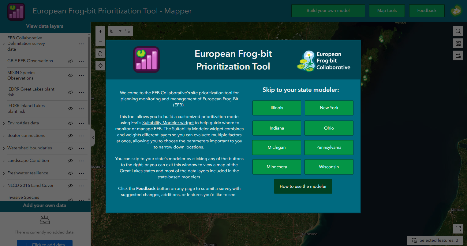
Prioritizing monitoring and management locations
The EFB Collaborative’s Prioritization Workgroup created a tool for prioritizing sites for monitoring or management of European Frog-bit. The tool allows users to choose which of over 40 different spatial layers to use in ArcGIS’ Suitability Modeler widget to help prioritize sites for each Great Lakes state. Version 1.0 of the tool is available to the public now!
Please let us know if you have any feedback so we can improve the tool for version 2.0.
Resources & Publications
Twitter Image: Protect Habitat
European Frog-bit Collaborative
Twitter Image: Preserve Habitat
European Frog-bit Collaborative
Status and strategy for European frog-bit (Hydrocharis morsus-ranae L.) management
Michigan Department of Environmental Quality and Central Michigan University